Construction happens, and with the right tools can be easy to navigate. The end of 2021 will include 18 miles of improved roads within the City of Duluth, the end of the Superior Street Reconstruction Project, and more work within Duluth’s Medical District. This site was created to help ease construction fears with providing up to date information from each project owner, and show you block by block were construction is happening, and how you can enjoy Duluth throughout the process.
Most construction projects will begin in April and could go as late as November, if necessary. Information will be updated weekly and will be included as a part of our weekly newsletter. Subscribe to that here to stay informed!
As you will see on the map, parking is located throughout different key areas throughout projects listed on this site. Parking spaces are available and convenient. If you are parking downtown or in Canal Park you can find the parking app here: https://www.duluthparking.com/services
Typically, crews will work from 7:00 a.m. until 7:00 p.m. Monday through Friday. Saturdays will be reserved for rain days or catch up days
Street detours will be indicated by street signage within the project zone. Leading into downtown, motorists will see several signs and street closure notices on the Department of Transportation digital boards. All areas will be marked with signage, and if possible, will include traffic operators.
All construction partners are aware of significant events in Duluth and are committed to ensuring that they are successful. A lot of work has gone into scheduling pieces of projects to create as little detours as possible while these events are taking place.
- For general project information click on the barricade icon.
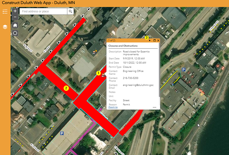
- For road closure information click on the colored polygon.
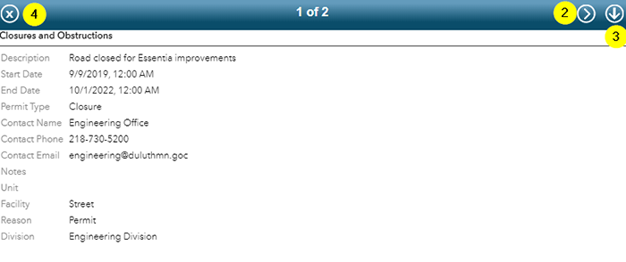
- Note that some projects will have multiple pages of information easily accessible via the > on the upper right of the pop up window.

- For general project information click on the barricade icon. A popup box will appear and you'll need to click the arrow to expand the information.
- Note that some projects will have multiple pages of information easily accessible via the > on the upper right of the pop up window.
- The down arrow will close popup information map and navigate back to original popup screen.
- The x icon in the upper left corner will close out all information regarding that project or road closure information.